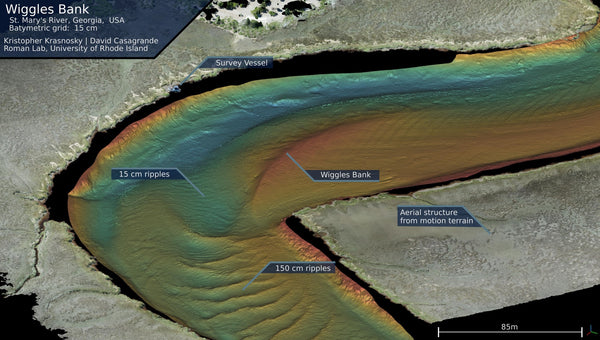
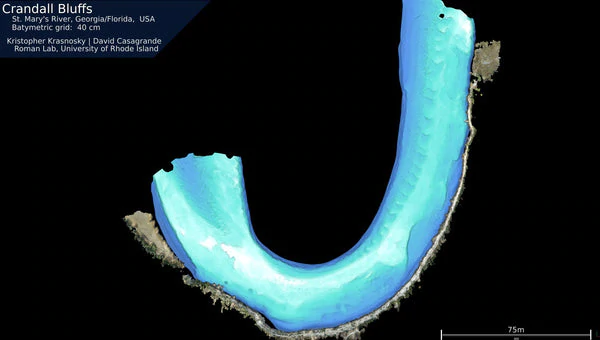
Oceanography students at the University of Rhode Island have been busy utilising the latest in WASSP Multibeam technology as part of their research studies.
The students who are specialising in marine robotics, remote sensing and mapping have recently started using a WASSP S3 Multibeam system as part of a project to survey inland ponds and coastal estuaries.
The students have deployed the WASSP Multibeam system aboard a specially developed autonomous kayak.
“We hope to accomplish a few things with the WASSP Multibeam in a number of projects,” says University of Rhode Island PHD student and researcher, Kristopher Krasnosky.
“Our unmanned vehicle is an autonomous kayak that can be deployed out of the bed of a pickup truck. We use it to collect environmental data and conduct bathymetric surveys. We also use it as a test platform for new autonomy algorithms.
“Currently we have a project to survey inland ponds and coastal estuaries. Our kayak is going to be the main workhorse for that project.”
During initial trials, the WASSP multibeam was able to profile ripples on the estuary floor up to 15cm in distance apart.

“I am using gaussian process regression (GPR), a computationally heavy bathymetry processing technique, to aid in autonomous survey path planning in real time. GPR also enhances the effective resolution of the finished multibeam map. This allows us to pull even more resolution out of the WASSP maps.”
Becoming the go-to system for the worlds hydrograhic survey industry, the WASSP S3 is purpose-built for survey and mapping and has been designed with the entry level market in mind: budget, operational needs, and future technology roll-out.
Scanning a 120 degrees swath port to starboard and using 224 beams, WASSP S3 can deliver accurate, high quality data in even the most demanding marine environments. By using advanced signal processing, you get a complete picture of seafloor bathymetry with ease. The S3 is one of the worlds most cost-effective professional survey and mapping multibeam sonar solutions.

“We decided to go with he WASSP system because it was the right balance of price to performance for our project. The other big selling point was the Linux API that the WASSP developers provided,” says Chris Roman, Ph.D. Professor of Oceanography University of Rhode Island Graduate School of Oceanography.
“It is critical for our work that we can read the data from the device in real time. We passed over several other systems (especially in this price range) because we simply could not interface with them the way we wished.”
Increasingly, WASSP Multibeam systems are being used by more research and scientific agencies, with WASSP Global Sales & Marketing Manager Rufus Whiteford saying it’s the flexibility of the WASSP system that makes it an easy and cost effective platform for organisations to use.
“We’re very pleased to see WASSP being used as a very serious tool for scientific and academic research. It speaks volumes about the credibility of our product and the flexibility of our interface,” says Whiteford.